

WeStroke Creek Scouting - Roaring River and Flat Creek
- Monday December 17, 2012
Upon waking up on Sunday, we quickly realized to our dismay that we had been skunked on rain... again. The plan was to head out to the plateau and run Daddy's or Clear Creek. Instead we decided to do some scouting around Cookeville, TN. There is a a gorge that goes through the area about 12 miles north of the center of Cookeville and we had heard and read about a couple of runs through there.
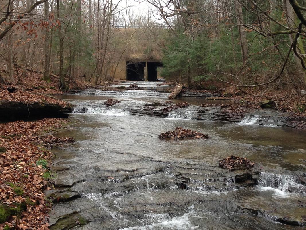
First we headed to the Roaring River. That is, we thought we were heading there. Where we ended up, was the head of Flat Creek. Here is some info on it including the geo coordinates. /rivers/usa/tennessee/flat-creek/highway-136-to-roaring-river/ The water was VERY low and we could see that there are a couple of drops and from reading up on it, one of them gets terminal at high water. Set safety if you are running it. Rest of it is pretty easy. It's about 2 miles from the put-in to the confluence of the Roaring River. You will then have about 1 mile of great Class II play and then the last 4 miles are Class I(II) with decent current. So we are thinking about 7 miles total. American Whitewater says 11.3 but we disagree. Will report back when we get enough water to run it. Check out the pics in the gallery.
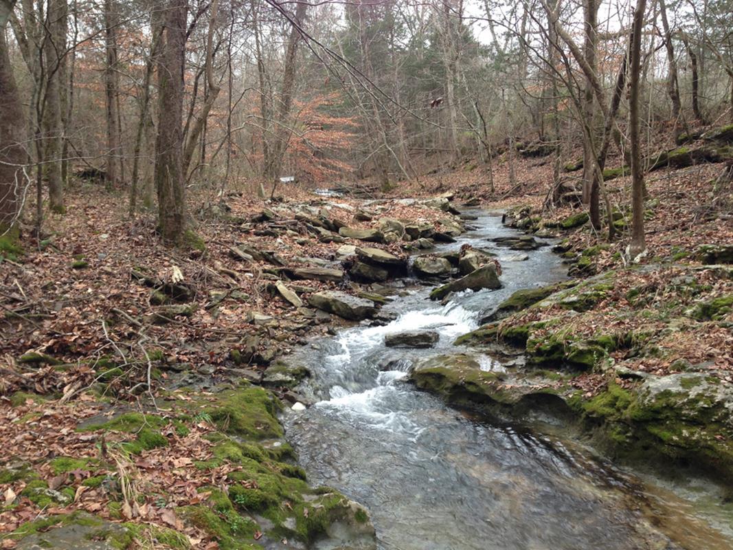
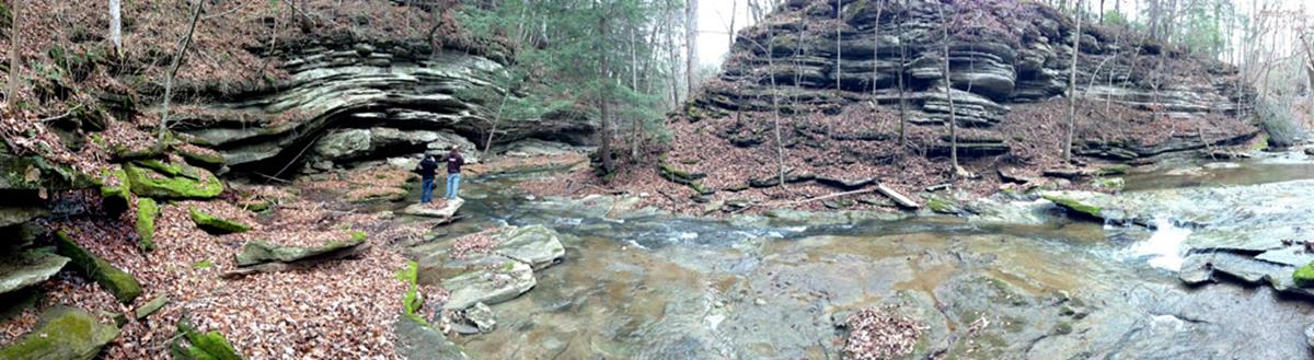
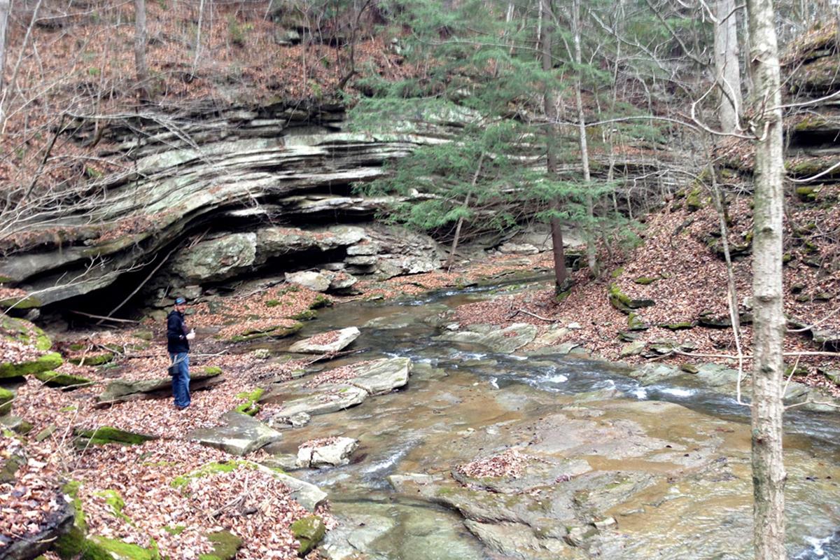
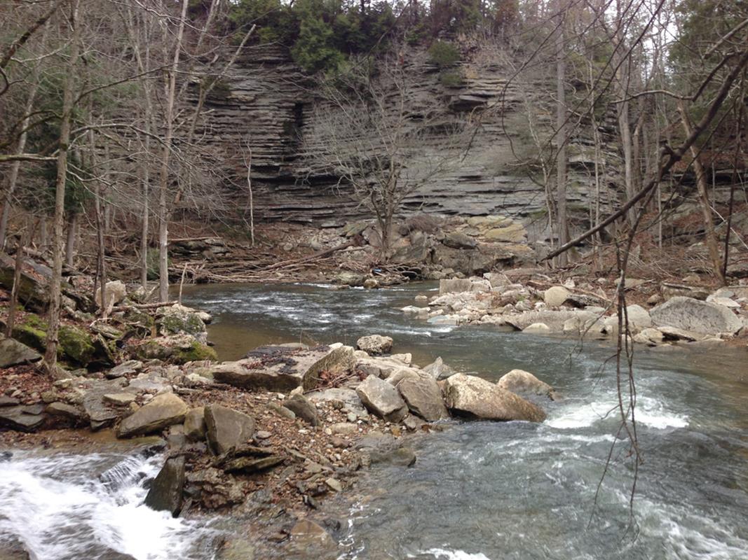

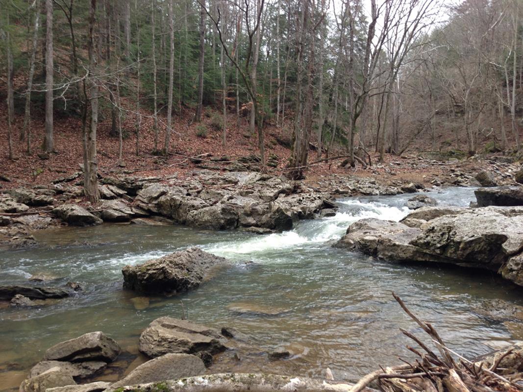
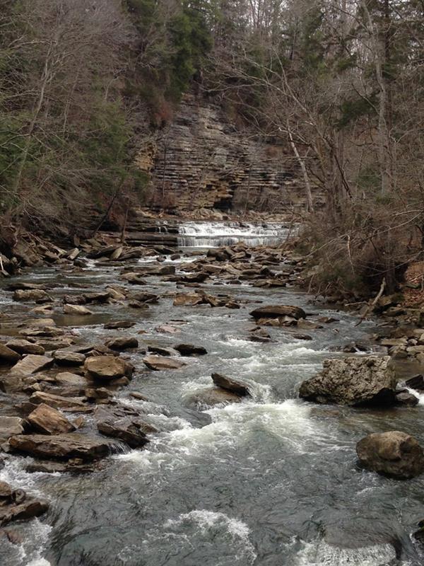
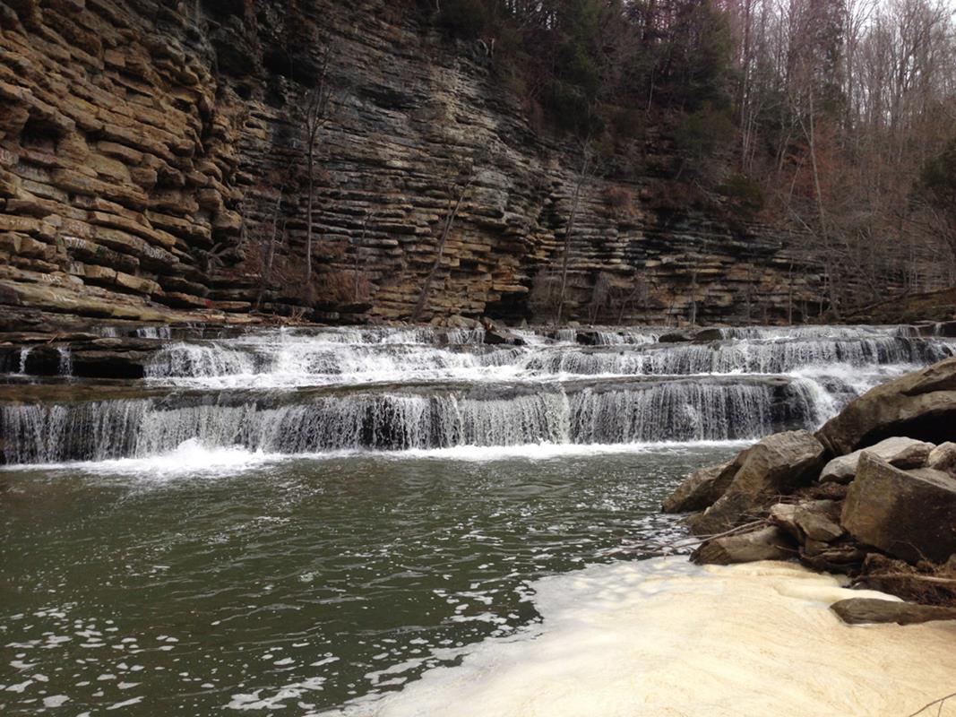
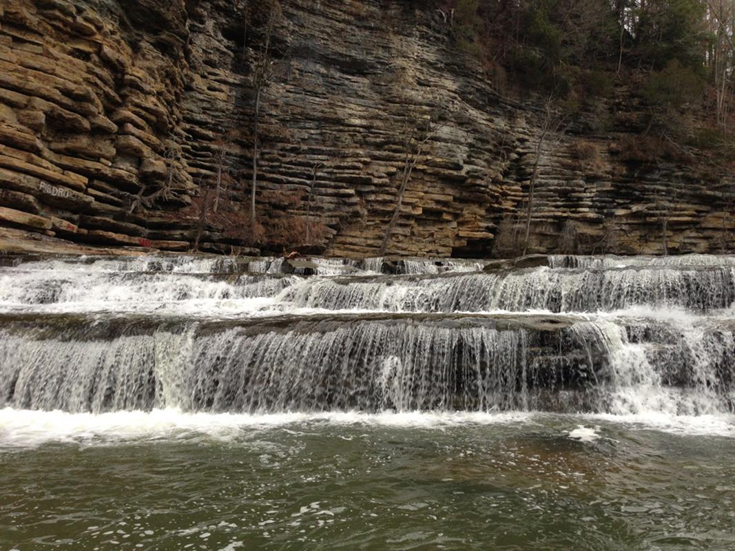
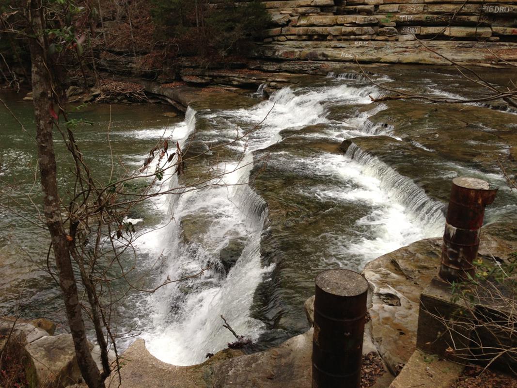
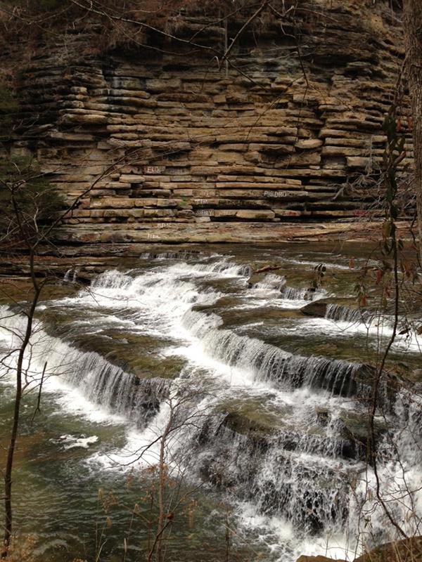
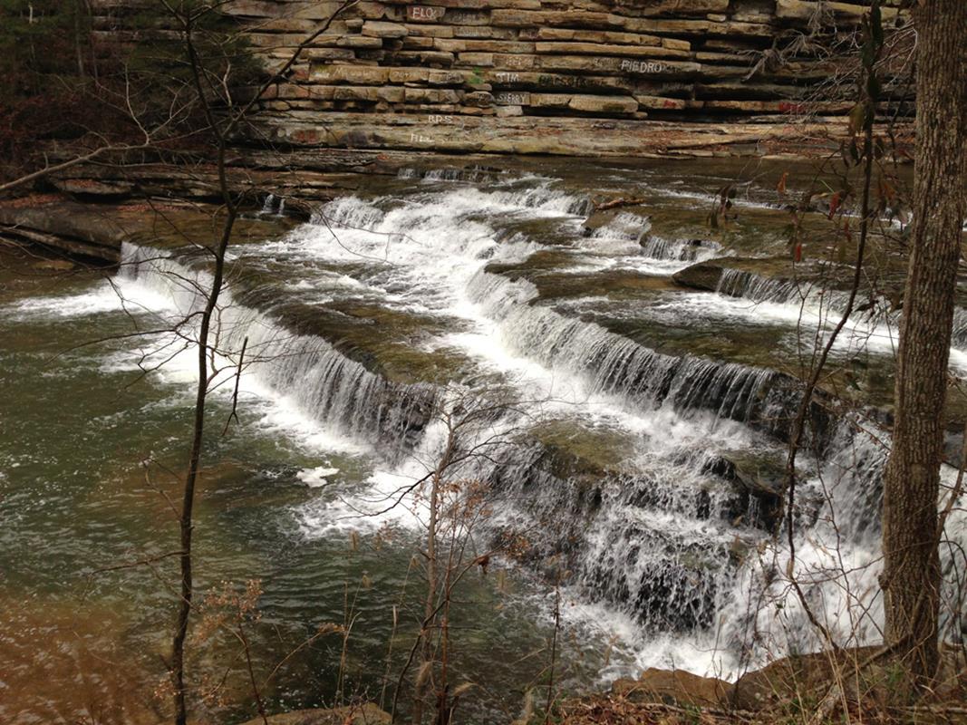
When we arrived at the confluence with the Roaring River, we were super stoked because it looked like a really cool waterway coming in. We spent the next few minutes being confused and checking our position on the GPS. We finally realized that we had just hiked down the wrong creek and were just now at our original destination, the Roaring River. We hiked upstream on Roaring River because that was supposed to be where the action is. We have read on American Whitewater that it is all Class III play and our scouting seems to confirm that. I have to say that the whole area is absolutely gorgeous and you can see the remains of 1 or possibly 2 mills.
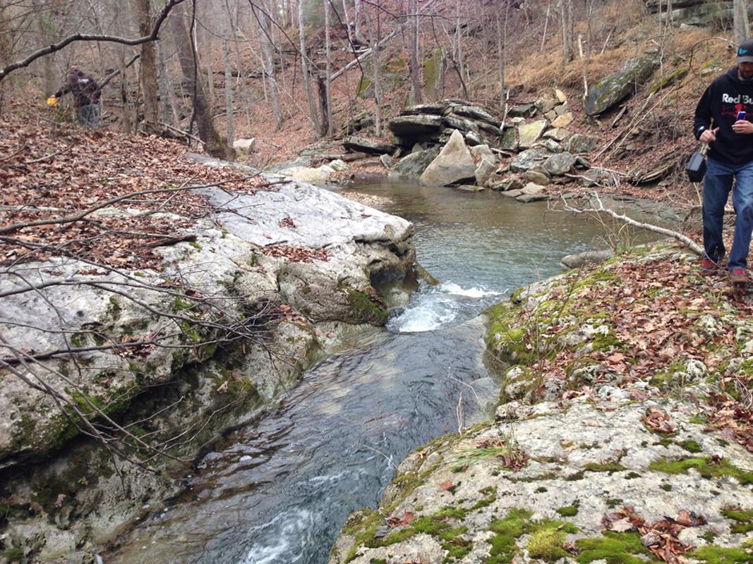
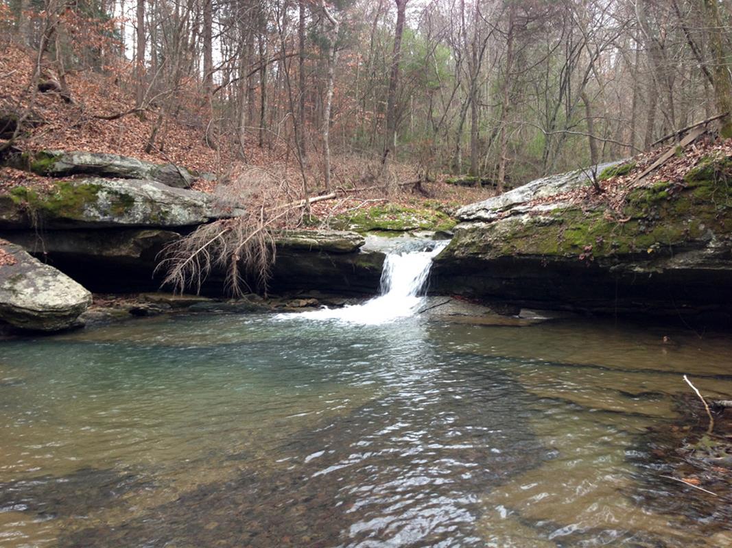
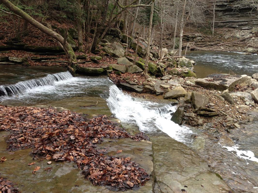
We could see multiple fun looking ledges and when we rounded the bend, we could see a nice size, multi-ledge drop. This drop is called Johnson Mills and reminded us a lot of the Upper Telico. We can confirm what we have read online about this particular rapid. You need to run the river right side of it, which is a 12 foot 30 degree slide followed by a 5 foot verticle drop at the end. DO NOT run the river left side as you can old Mill debris, rebar, etc. GPS Coordinates for the Put-In are 36.3377,-85.3767 and the Take Out are 36.3744,-85.6452. The run is Class III play for 1.5 miles including Johnson Mill. Then you hit the confluence with Flat Creek and you will then have about 1 mile of great Class II play and then the last 4 miles are Class I(II) with decent current.You can go to http://www.americanwhitewater.org/content/River/detail/id/1786/ for more information and check out the gallery above for photos.